


Can you name the capitals of Mexico’s states?
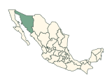
Each round highlights one of Mexico’s states on the map; type its capital. The quiz asks for 19 capitals, leaving out the places whose capital gives the answer away and those with no separate capital. Accents are optional, and short forms of long official names count. There is no timer, and a wrong guess can be tried again.
How to play
- Each round highlights one state on the map of Mexico and names it below the map; a place too small to see is circled. Type its capital in the box at the bottom. Capital letters, accents and punctuation do not matter, and alternative spellings are accepted.
- A correct capital is accepted by itself after a short pause: the place turns green and the next one is highlighted. Press Enter to check any other answer.
- A wrong guess is marked so you can try again, as often as you like. There is no timer.
- Stuck? Press Finish to end the run: the capital is revealed and that place counts as missed.
- The 19 federal entities come in shuffled order, each once. Your score counts up to 19 at the top of the board, and naming the last capital completes the run. The answer review below the board lists every round.
- Your result is saved in this browser. Once enough people have played a game, the results also show how your score ranks, and you can copy or share an image of your result, or replay.
Tips for playing
Several capitals are not their state’s biggest city: Mexicali rather than Tijuana in Baja California, Xalapa rather than the port of Veracruz in Veracruz, and Chilpancingo rather than Acapulco in Guerrero. Toluca is the capital of the State of Mexico.
All 19 capitals in the quiz
Show all 19 answers
| State | Capital | Also accepted |
|---|---|---|
| Baja California | Mexicali | — |
| Baja California Sur | La Paz | — |
| Chiapas | Tuxtla Gutiérrez | Tuxtla Gutierrez, Tuxtla |
| Coahuila | Saltillo | — |
| Guerrero | Chilpancingo | Chilpancingo de los Bravo |
| Hidalgo | Pachuca | Pachuca de Soto |
| Jalisco | Guadalajara | — |
| State of Mexico | Toluca | Toluca de Lerdo |
| Michoacán | Morelia | — |
| Morelos | Cuernavaca | — |
| Nayarit | Tepic | — |
| Nuevo León | Monterrey | — |
| Quintana Roo | Chetumal | — |
| Sinaloa | Culiacán | Culiacan, Culiacán Rosales, Culiacan Rosales |
| Sonora | Hermosillo | — |
| Tabasco | Villahermosa | — |
| Tamaulipas | Ciudad Victoria | Victoria |
| Veracruz | Xalapa | Xalapa-Enríquez, Xalapa-Enriquez, Jalapa |
| Yucatán | Mérida | Merida |
Every name in the last column is accepted too. Not asked: Aguascalientes, Campeche, Chihuahua, Colima, Durango, Guanajuato, Oaxaca, Puebla, Querétaro, San Luis Potosí, Tlaxcala and Zacatecas, whose capital shares the place’s name; Mexico City, with no separate capital.
Frequently asked questions
How many capitals are in the quiz?
19 of the 32 federal entities. The 12 states whose capitals’ names give the answer away are left out. Mexico City has no separate capital.
Which other spellings are accepted?
“Tuxtla Gutierrez” and “Tuxtla” for Tuxtla Gutiérrez, “Chilpancingo de los Bravo” for Chilpancingo, “Pachuca de Soto” for Pachuca and “Toluca de Lerdo” for Toluca. Capital letters, accents and punctuation never matter.
Is Mexico City in the quiz?
No. Mexico City is the national capital and a federal entity of its own, with no separate capital to ask for.
Is there a time limit?
No. Take as long as you like: a wrong guess can be tried again, and Finish ends the run whenever you want to stop.
Which capitals count?
The quiz asks for the capitals of 19 of the 32 federal entities of Mexico, as listed in the answer key below and checked against the references under Sources. 12 states, such as Aguascalientes, Campeche and Chihuahua, are left out because the capital contains the place’s name or the other way round. Mexico City has no separate capital.
Where a place shares its capital, splits it between two cities or has a separate seat of government, every listed city is accepted. The map quiz for the same country asks for the places themselves.
More about Mexico
Sources
Source: Natural Earth · Admin-1 states and provinces, 1:10m, v5.1.2
Public domain boundaries, simplified for a quiz. Projection: Lambert conformal conic, standard parallels 17.5°N and 29.5°N, central meridian 102°W (INEGI Lambert). 32 federal entities: 31 states plus Mexico City (ISO code MX-CMX since 2016; Natural Earth still labels it MX-DIF). An unassigned Natural Earth reef polygon (Alacranes, MX-X01~) is omitted. The Revillagigedo Islands (Colima) are not drawn. Names, groups, alternative names and capitals are curated from the references below; codes follow ISO 3166-2. The map is not a surveying or legal reference.
Found an incorrect answer or a source that needs updating? Send a correction with the game name and a reference.