
Can you name all 31 states of Mexico and Mexico City?
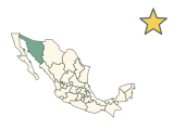
Mexico has 31 states and Mexico City, 32 federal entities in all. Fill in the map from Baja California in the north-west to Quintana Roo on the Caribbean coast. Accents are optional, and there is no timer.
How to play
- Type the name of any state in the box at the bottom of the map. Capital letters, accents and punctuation do not matter, and names without accents such as “Yucatan” or “Michoacan” are accepted, as is “CDMX” for Mexico City.
- A correct name is accepted by itself after a short pause. It turns green on the map and is ticked off in its group below the map. A wrong name costs nothing; just keep typing.
- Use the + and − buttons to zoom in on small states, then drag to move around. With the map selected, the + and − keys zoom and the arrow keys move it. Select a state you have named to highlight it.
- There is no timer. The game ends when you have named all 32, or press Finish at any time to end it and reveal the states you missed.
- Your result is saved in this browser. Once enough people have played a game, the results also show how your score ranks, and you can copy or share an image of your result, or replay.
Tips for playing
Start with the long Baja California peninsula, which holds two states, and the states along the US border, then work south through the centre. Several of the smallest states sit close to Mexico City, so zoom in there for Tlaxcala, Morelos and the State of Mexico. Finish on the Yucatán Peninsula: Campeche, Yucatán and Quintana Roo.
All 32 federal entities of Mexico
Show all 32 answers
| State | Capital | Also accepted |
|---|---|---|
| Aguascalientes | Aguascalientes | AGS |
| Baja California | Mexicali | BC |
| Baja California Sur | La Paz | BCS |
| Campeche | Campeche | — |
| Chiapas | Tuxtla Gutiérrez | — |
| Chihuahua | Chihuahua | — |
| Coahuila | Saltillo | Coahuila de Zaragoza |
| Colima | Colima | — |
| Durango | Durango | — |
| Guanajuato | Guanajuato | — |
| Guerrero | Chilpancingo | — |
| Hidalgo | Pachuca | — |
| Jalisco | Guadalajara | — |
| State of Mexico | Toluca | México, Mexico, Estado de México, Estado de Mexico, Mexico State, Edomex |
| Mexico City | — | Ciudad de México, Ciudad de Mexico, CDMX, Distrito Federal, México D.F., Mexico D.F., DF |
| Michoacán | Morelia | Michoacan, Michoacán de Ocampo, Michoacan de Ocampo |
| Morelos | Cuernavaca | — |
| Nayarit | Tepic | — |
| Nuevo León | Monterrey | Nuevo Leon, NL |
| Oaxaca | Oaxaca | — |
| Puebla | Puebla | — |
| Querétaro | Querétaro | Queretaro, Querétaro de Arteaga, Queretaro de Arteaga |
| Quintana Roo | Chetumal | QRoo |
| San Luis Potosí | San Luis Potosí | San Luis Potosi, SLP |
| Sinaloa | Culiacán | — |
| Sonora | Hermosillo | — |
| Tabasco | Villahermosa | — |
| Tamaulipas | Ciudad Victoria | — |
| Tlaxcala | Tlaxcala | — |
| Veracruz | Xalapa | Veracruz de Ignacio de la Llave |
| Yucatán | Mérida | Yucatan |
| Zacatecas | Zacatecas | — |
Names as the quiz shows them, grouped as the game groups them, with each capital for reference; the quiz asks only for the names. Every name in the last column is accepted too. Mexico City has no separate capital.
Frequently asked questions
How many states does Mexico have?
31, plus Mexico City, which is a federal entity of its own. The quiz asks for all 32.
Is “Mexico” accepted for the State of Mexico?
Yes. “Mexico”, “Estado de México” and “Edomex” all fill in the State of Mexico, which surrounds Mexico City on three sides. Mexico City itself takes “Mexico City”, “Ciudad de México”, “CDMX” or “DF”.
Is Mexico City a state?
Not quite. Mexico City is the national capital and a federal entity in its own right, not one of the states, but it counts as an answer here. Until 2016 it was the Federal District, so “DF” is accepted too.
Which Mexican states share a name with their capital?
12 of them: Aguascalientes, Campeche, Chihuahua, Colima, Durango, Guanajuato, Oaxaca, Puebla, Querétaro, San Luis Potosí, Tlaxcala and Zacatecas. The other 19 states have capitals with different names, such as Guadalajara (Jalisco) and Monterrey (Nuevo León). Mexico City has no separate capital.
Which is the largest of Mexico’s states?
Chihuahua. Measured on this map, it covers the most area of the 32 answers, and Mexico City the least.
Big states in the north, small ones in the centre
The states along the US border are among the largest on the map, while several of the smallest sit near Mexico City. Once the north is filled in, spend your time in the centre, where one zoom shows half a dozen states at once.
Which states count?
All 32 federal entities: the 31 states and Mexico City. Islands count with the state that governs them, such as Cozumel with Quintana Roo; the remote Revillagigedo Islands are not drawn.
More about Mexico
Sources
Source: Natural Earth · Admin-1 states and provinces, 1:10m, v5.1.2
Public domain boundaries, simplified for a quiz. Projection: Lambert conformal conic, standard parallels 17.5°N and 29.5°N, central meridian 102°W (INEGI Lambert). 32 federal entities: 31 states plus Mexico City (ISO code MX-CMX since 2016; Natural Earth still labels it MX-DIF). An unassigned Natural Earth reef polygon (Alacranes, MX-X01~) is omitted. The Revillagigedo Islands (Colima) are not drawn. Names, groups, alternative names and capitals are curated from the references below; codes follow ISO 3166-2. The map is not a surveying or legal reference.
Found an incorrect answer or a source that needs updating? Send a correction with the game name and a reference.