Can you name all 28 states and 8 union territories of India?
India has 28 states and 8 union territories. This map quiz asks for all 36, from Ladakh and Jammu and Kashmir in the north to Tamil Nadu, Lakshadweep and the Andaman and Nicobar Islands in the south. The smallest union territories are marked with a dot.
How to play
- Type the name of any state or union territory in the box at the bottom of the map. Capital letters, accents and punctuation do not matter, and older or shorter names such as “Orissa”, “Pondicherry” or “J&K” are accepted.
- A correct name is accepted by itself after a short pause. It turns green on the map and is ticked off in its group below the map. A wrong name costs nothing; just keep typing.
- Use the + and − buttons to zoom in on small states and union territories, then drag to move around. With the map selected, the + and − keys zoom and the arrow keys move it. Select a state or union territory you have named to highlight it.
- There is no timer. The game ends when you have named all 36, or press Finish at any time to end it and reveal the states and union territories you missed.
- Your result is saved in this browser. Once enough people have played a game, the results also show how your score ranks, and you can copy or share an image of your result, or replay.
Tips for playing
Split the map into regions: the north (Punjab, Haryana, Himachal Pradesh, Uttarakhand and Uttar Pradesh), the west coast from Gujarat to Kerala, the east coast from West Bengal to Tamil Nadu, and the seven north-eastern states plus Sikkim. Zoom in for Goa and for the union territories marked with dots.
All 36 states and union territories of India
Show all 36 answers
States (28)
| State or union territory | Capital | Also accepted |
|---|---|---|
| Andhra Pradesh | Amaravati | AP |
| Arunachal Pradesh | Itanagar | — |
| Assam | Dispur | — |
| Bihar | Patna | — |
| Chhattisgarh | Raipur | Chattisgarh |
| Goa | Panaji | — |
| Gujarat | Gandhinagar | — |
| Haryana | Chandigarh | — |
| Himachal Pradesh | Shimla | HP |
| Jharkhand | Ranchi | — |
| Karnataka | Bengaluru | — |
| Kerala | Thiruvananthapuram | — |
| Madhya Pradesh | Bhopal | MP |
| Maharashtra | Mumbai | — |
| Manipur | Imphal | — |
| Meghalaya | Shillong | — |
| Mizoram | Aizawl | — |
| Nagaland | Kohima | — |
| Odisha | Bhubaneswar | Orissa |
| Punjab | Chandigarh | — |
| Rajasthan | Jaipur | — |
| Sikkim | Gangtok | — |
| Tamil Nadu | Chennai | TN |
| Telangana | Hyderabad | — |
| Tripura | Agartala | — |
| Uttar Pradesh | Lucknow | UP |
| Uttarakhand | Dehradun | Uttaranchal |
| West Bengal | Kolkata | WB |
Union territories (8)
| State or union territory | Capital | Also accepted |
|---|---|---|
| Andaman and Nicobar Islands | Sri Vijaya Puram | Andaman and Nicobar, Andaman & Nicobar Islands, Andaman & Nicobar |
| Chandigarh | Chandigarh | — |
| Dadra and Nagar Haveli and Daman and Diu | Daman | Dadra & Nagar Haveli and Daman & Diu, DNHDD, Dadra and Nagar Haveli, Daman and Diu |
| Delhi | New Delhi | NCT of Delhi, National Capital Territory of Delhi |
| Jammu and Kashmir | Srinagar | Jammu & Kashmir, J&K |
| Ladakh | Leh | — |
| Lakshadweep | Kavaratti | — |
| Puducherry | Puducherry | Pondicherry |
Names as the quiz shows them, grouped as the game groups them, with each capital for reference; the quiz asks only for the names. Every name in the last column is accepted too.
Frequently asked questions
How many states and union territories does India have?
28 states and 8 union territories, 36 in all. The union territories are Andaman and Nicobar Islands, Chandigarh, Dadra and Nagar Haveli and Daman and Diu, Delhi, Jammu and Kashmir, Ladakh, Lakshadweep and Puducherry.
Are old names like Orissa and Uttaranchal accepted?
Yes. Odisha also takes “Orissa”, Uttarakhand “Uttaranchal” and Puducherry “Pondicherry”, and short forms such as “UP”, “MP” or “J&K” work too. Capital letters and punctuation do not matter.
How does the map show India’s borders?
It follows Natural Earth’s de facto boundaries, which show the line of control in Kashmir rather than the official Survey of India boundary. The map is drawn for a quiz and is not a statement about borders; neighbouring countries are not drawn.
Which states share a capital?
Haryana and Punjab share Chandigarh, which is also a union territory in its own right. 5 states and union territories split the role between two cities. In Himachal Pradesh, Shimla is the capital; Dharamshala is the winter (second) capital. In Maharashtra, Mumbai is the capital; Nagpur is the winter (second) capital. In Uttarakhand, Dehradun is the administrative (winter) capital; Bhararisain (Gairsain) is the summer capital. In Jammu and Kashmir, Srinagar is the summer capital and Jammu the winter capital. In Ladakh, Leh is the administrative capital; Kargil is a joint capital.
Which is the largest of India’s states and union territories?
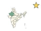
Rajasthan. Measured on this map, it covers the most area of the 36 answers, and Lakshadweep the least.
A list that changed recently
In 2019 Jammu and Kashmir became a union territory and Ladakh was separated from it as another, and in 2020 Dadra and Nagar Haveli merged with Daman and Diu. Telangana, formed in 2014, is the newest state. Older maps and quizzes may still show the earlier lists.
Which states and union territories count?
All 28 states and 8 union territories. The Andaman and Nicobar Islands and Lakshadweep are answers of their own. Boundaries follow Natural Earth’s de facto lines, and neighbouring countries are not drawn.
More about India
Sources
Source: Natural Earth · Admin-1 states and provinces, 1:10m, v5.1.2
Public domain boundaries, simplified for a quiz. Projection: Lambert conformal conic, standard parallels 12.5°N and 32°N, central meridian 80°E. 28 states and 8 union territories as of 2026: Ladakh separate from Jammu and Kashmir (2019); Dadra and Nagar Haveli merged with Daman and Diu (2020). ISO codes follow the 2023 ISO 3166-2:IN update (IN-OD, IN-CG, IN-TS, IN-UK); Natural Earth still uses IN-OR, IN-CT, IN-TG and IN-UT. Port Blair was renamed Sri Vijaya Puram by gazette notification in September 2024. Boundaries follow Natural Earth's de facto depiction (line of control in Kashmir), not the official Survey of India boundary. Names, groups, alternative names and capitals are curated from the references below; codes follow ISO 3166-2. The map is not a surveying or legal reference.
Found an incorrect answer or a source that needs updating? Send a correction with the game name and a reference.