Can you name all 6 states and 2 territories of Australia?
Australia has 6 states and 2 mainland territories with their own governments: the Northern Territory and the Australian Capital Territory around Canberra. Name all 8 to fill in the map. Abbreviations count, and there is no timer.
How to play
- Type the name of any state or territory in the box at the bottom of the map. Capital letters, accents and punctuation do not matter, and abbreviations such as “NSW”, “QLD” or “WA” are accepted.
- A correct name is accepted by itself after a short pause. It turns green on the map and is ticked off in its group below the map. A wrong name costs nothing; just keep typing.
- Use the + and − buttons to zoom in on small states and territories, then drag to move around. With the map selected, the + and − keys zoom and the arrow keys move it. Select a state or territory you have named to highlight it.
- There is no timer. The game ends when you have named all 8, or press Finish at any time to end it and reveal the states and territories you missed.
- Your result is saved in this browser. Once enough people have played a game, the results also show how your score ranks, and you can copy or share an image of your result, or replay.
Tips for playing
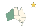
Western Australia covers roughly the western third of the map. East of it, the Northern Territory sits above South Australia. Queensland, New South Wales and Victoria run down the east coast, and Tasmania is the island to the south. The Australian Capital Territory is a small enclave inside New South Wales, so zoom in to see it.
All 8 states and territories of Australia
Show all 8 answers
States (6)
| State or territory | Capital | Also accepted |
|---|---|---|
| New South Wales | Sydney | NSW |
| Queensland | Brisbane | QLD |
| South Australia | Adelaide | SA |
| Tasmania | Hobart | TAS |
| Victoria | Melbourne | VIC |
| Western Australia | Perth | WA |
Territories (2)
| State or territory | Capital | Also accepted |
|---|---|---|
| Australian Capital Territory | Canberra | ACT |
| Northern Territory | Darwin | NT |
Names as the quiz shows them, grouped as the game groups them, with each capital for reference; the quiz asks only for the names. Every name in the last column is accepted too.
Frequently asked questions
How many states and territories does Australia have?
6 states and 2 mainland territories, 8 answers in all: New South Wales, Queensland, South Australia, Tasmania, Victoria, Western Australia, Australian Capital Territory and Northern Territory.
Can I type NSW or ACT?
Yes. Every state and territory’s usual abbreviation counts: “NSW”, “QLD”, “SA”, “TAS”, “VIC”, “WA”, “ACT” and “NT”.
Why are there only two territories?
The quiz counts the two mainland territories that govern themselves. The Jervis Bay Territory and the external territories, such as Norfolk Island and Christmas Island, are not answers, and Lord Howe Island and Macquarie Island are not drawn.
What are the capitals of the Australian states and territories?
Sydney (New South Wales), Brisbane (Queensland), Adelaide (South Australia), Hobart (Tasmania), Melbourne (Victoria), Perth (Western Australia), Canberra (Australian Capital Territory) and Darwin (Northern Territory). Canberra is also the national capital.
Which is the largest of Australia’s states and territories?
Western Australia. Measured on this map, it covers the most area of the 8 answers, and the Australian Capital Territory the least.
Eight answers, mostly straight borders
With only eight answers, this is a quick map to complete, so aim for a perfect score before moving on to a bigger country. Most of the borders follow lines of latitude and longitude, which makes the shapes easy to remember once you have seen them.
Which states and territories count?
The 6 states and the 2 mainland territories. Islands count with their state, such as Kangaroo Island with South Australia and the smaller islands around Tasmania with Tasmania.
More about Australia
Sources
Source: Natural Earth · Admin-1 states and provinces, 1:10m, v5.1.2
Public domain boundaries, simplified for a quiz. Projection: Lambert conformal conic, standard parallels 18°S and 36°S, central meridian 134°E (Geoscience Australia Lambert). Six states plus the two mainland self-governing territories. External territories and the Jervis Bay Territory are not included; Lord Howe Island (NSW) and Macquarie Island (Tasmania) are not drawn. Names, groups, alternative names and capitals are curated from the references below; codes follow ISO 3166-2. The map is not a surveying or legal reference.
Found an incorrect answer or a source that needs updating? Send a correction with the game name and a reference.