


Can you name the capitals of Brazil’s states?
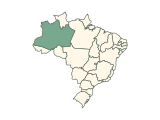
Each round highlights one of Brazil’s states on the map; type its capital. The quiz asks for 25 capitals, leaving out the places whose capital gives the answer away. Accents are optional. There is no timer, and a wrong guess can be tried again.
How to play
- Each round highlights one state on the map of Brazil and names it below the map; a place too small to see is circled. Type its capital in the box at the bottom. Capital letters, accents and punctuation do not matter, and alternative spellings are accepted.
- A correct capital is accepted by itself after a short pause: the place turns green and the next one is highlighted. Press Enter to check any other answer.
- A wrong guess is marked so you can try again, as often as you like. There is no timer.
- Stuck? Press Finish to end the run: the capital is revealed and that place counts as missed.
- The 25 federative units come in shuffled order, each once. Your score counts up to 25 at the top of the board, and naming the last capital completes the run. The answer review below the board lists every round.
- Your result is saved in this browser. Once enough people have played a game, the results also show how your score ranks, and you can copy or share an image of your result, or replay.
Tips for playing
Most capitals are on or near the coast, from Belém and Fortaleza to Florianópolis and Porto Alegre. The inland ones include Manaus on the Amazon, Cuiabá, Goiânia, Campo Grande and Palmas, the capital of Tocantins, a state created in 1988.
All 25 capitals in the quiz
Show all 25 answers
North (7)
| State | Capital | Also accepted |
|---|---|---|
| Acre | Rio Branco | — |
| Amapá | Macapá | Macapa |
| Amazonas | Manaus | — |
| Pará | Belém | Belem |
| Rondônia | Porto Velho | — |
| Roraima | Boa Vista | — |
| Tocantins | Palmas | — |
Northeast (9)
| State | Capital | Also accepted |
|---|---|---|
| Alagoas | Maceió | Maceio |
| Bahia | Salvador | — |
| Ceará | Fortaleza | — |
| Maranhão | São Luís | Sao Luis |
| Paraíba | João Pessoa | Joao Pessoa |
| Pernambuco | Recife | — |
| Piauí | Teresina | — |
| Rio Grande do Norte | Natal | — |
| Sergipe | Aracaju | — |
Central-West (4)
| State | Capital | Also accepted |
|---|---|---|
| Federal District | Brasília | Brasilia |
| Goiás | Goiânia | Goiania |
| Mato Grosso | Cuiabá | Cuiaba |
| Mato Grosso do Sul | Campo Grande | — |
Southeast (2)
| State | Capital | Also accepted |
|---|---|---|
| Espírito Santo | Vitória | Vitoria |
| Minas Gerais | Belo Horizonte | — |
South (3)
| State | Capital | Also accepted |
|---|---|---|
| Paraná | Curitiba | — |
| Rio Grande do Sul | Porto Alegre | — |
| Santa Catarina | Florianópolis | Florianopolis |
Every name in the last column is accepted too. Not asked: Rio de Janeiro and São Paulo, whose capital shares the place’s name.
Frequently asked questions
How many capitals are in the quiz?
25 of the 27 federative units. Rio de Janeiro and São Paulo, whose capitals’ names give the answer away, are left out.
Which other spellings are accepted?
“Macapa” for Macapá, “Belem” for Belém, “Maceio” for Maceió and “Sao Luis” for São Luís. Capital letters, accents and punctuation never matter.
Is Brasília in the quiz?
Yes. Brasília is the answer for the Federal District, which holds the national capital.
Is there a time limit?
No. Take as long as you like: a wrong guess can be tried again, and Finish ends the run whenever you want to stop.
Which capitals count?
The quiz asks for the capitals of 25 of the 27 federative units of Brazil, as listed in the answer key below and checked against the references under Sources. Rio de Janeiro and São Paulo are left out because the capital contains the place’s name or the other way round.
Where a place shares its capital, splits it between two cities or has a separate seat of government, every listed city is accepted. The map quiz for the same country asks for the places themselves.
More about Brazil
Sources
Source: Natural Earth · Admin-1 states and provinces, 1:10m, v5.1.2
Public domain boundaries, simplified for a quiz. Projection: Lambert conformal conic, standard parallels 1°S and 27°S, central meridian 54°W. 26 states plus the Federal District; groups are the five IBGE macro-regions. Oceanic islands east of 34°W (Fernando de Noronha, Atol das Rocas, St Peter and St Paul Rocks, Trindade and Martim Vaz) are not drawn. Names, groups, alternative names and capitals are curated from the references below; codes follow ISO 3166-2. The map is not a surveying or legal reference.
Found an incorrect answer or a source that needs updating? Send a correction with the game name and a reference.